Portfolio
Our Work
Real results from real missions
We're looking for 3–4 property owners, builders or organizations with a building, hall or other property they'd like captured as a detailed 3D model.
Professional aerial data powered by DJI Matrice 4E and photogrammetry
Georeferenced aerial imagery captured with RTK GPS precision. GeoTIFF output ready for any GIS platform — ideal for area planning, documentation, and change detection.
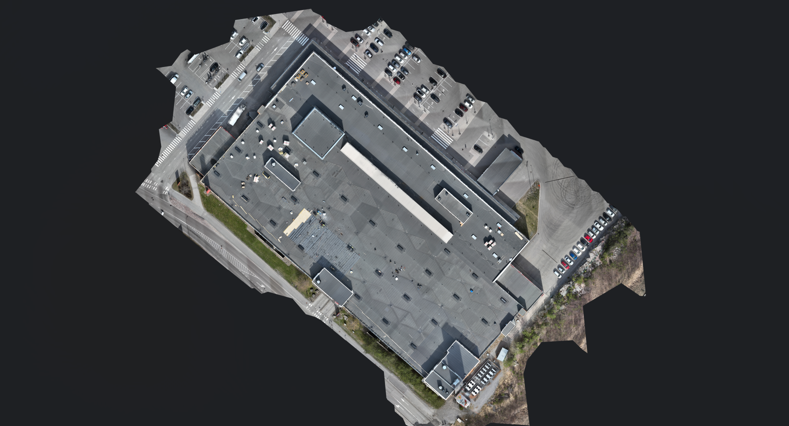
Photogrammetric reconstruction from overlapping aerial images — dense point clouds, textured mesh models, and digital surface/terrain models (DSM/DTM) with survey-grade accuracy.
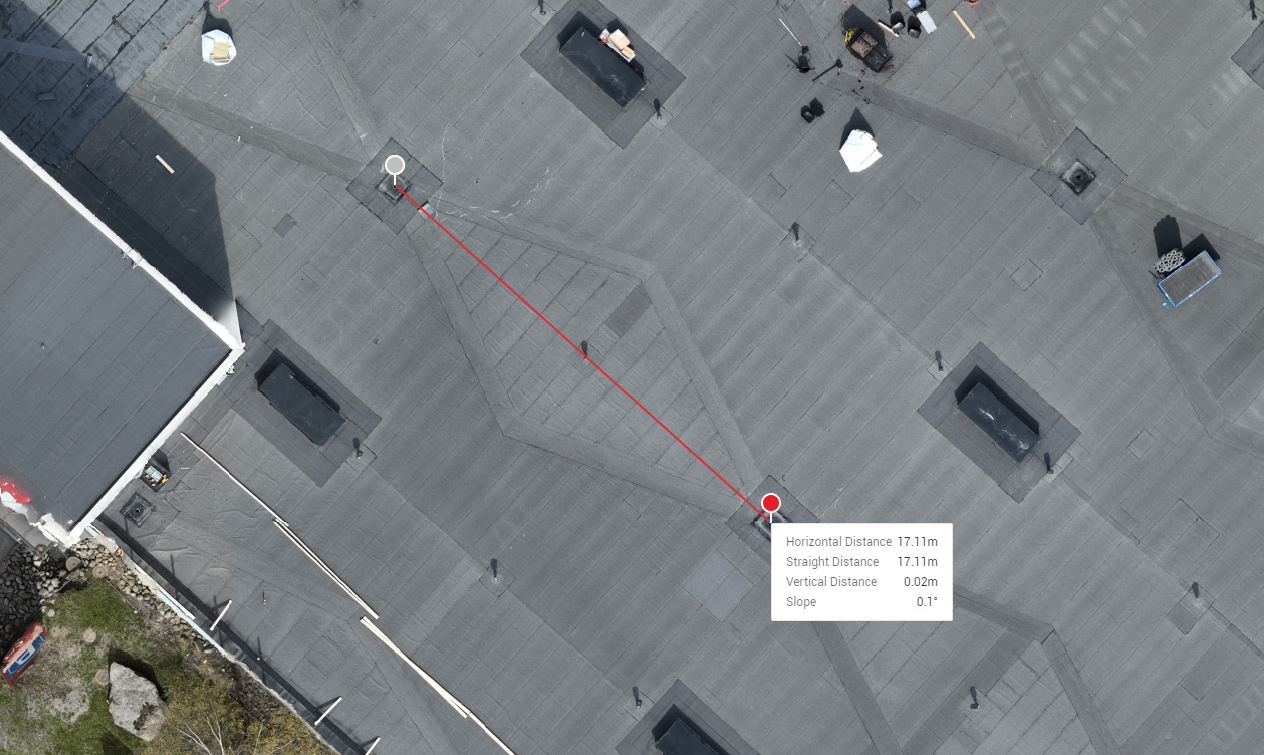
High-resolution visual inspection of roofs, facades, bridges, towers, and infrastructure. Safer and more detailed than manual access — no scaffolding or rope access required.
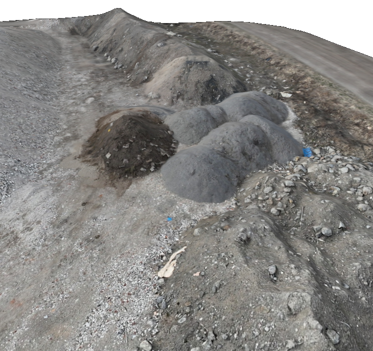
Accurate stockpile volumes and cut/fill earthwork calculations derived from photogrammetric surface models. Track quantities and site progress without manual surveying.
Site surveys, progress monitoring, volume calculations, and as-built documentation throughout the entire project lifecycle.
Urban planning, infrastructure inspection, land management, and public facility surveys with official-grade accuracy.
Stand mapping, canopy analysis, terrain modelling, and harvest planning — covering large areas quickly and accurately.
Real results from real missions
FMS RaptorScan is a drone mapping and inspection company based in Vaasa, Pohjanmaa. We fly the DJI Matrice 4E — a professional survey drone equipped with RTK GPS and a 48 MP mechanical-shutter camera built for high-accuracy photogrammetry.
Whether you need a one-off site inspection or a recurring mapping programme, we adapt to your workflow and deliver results in the formats your team uses.
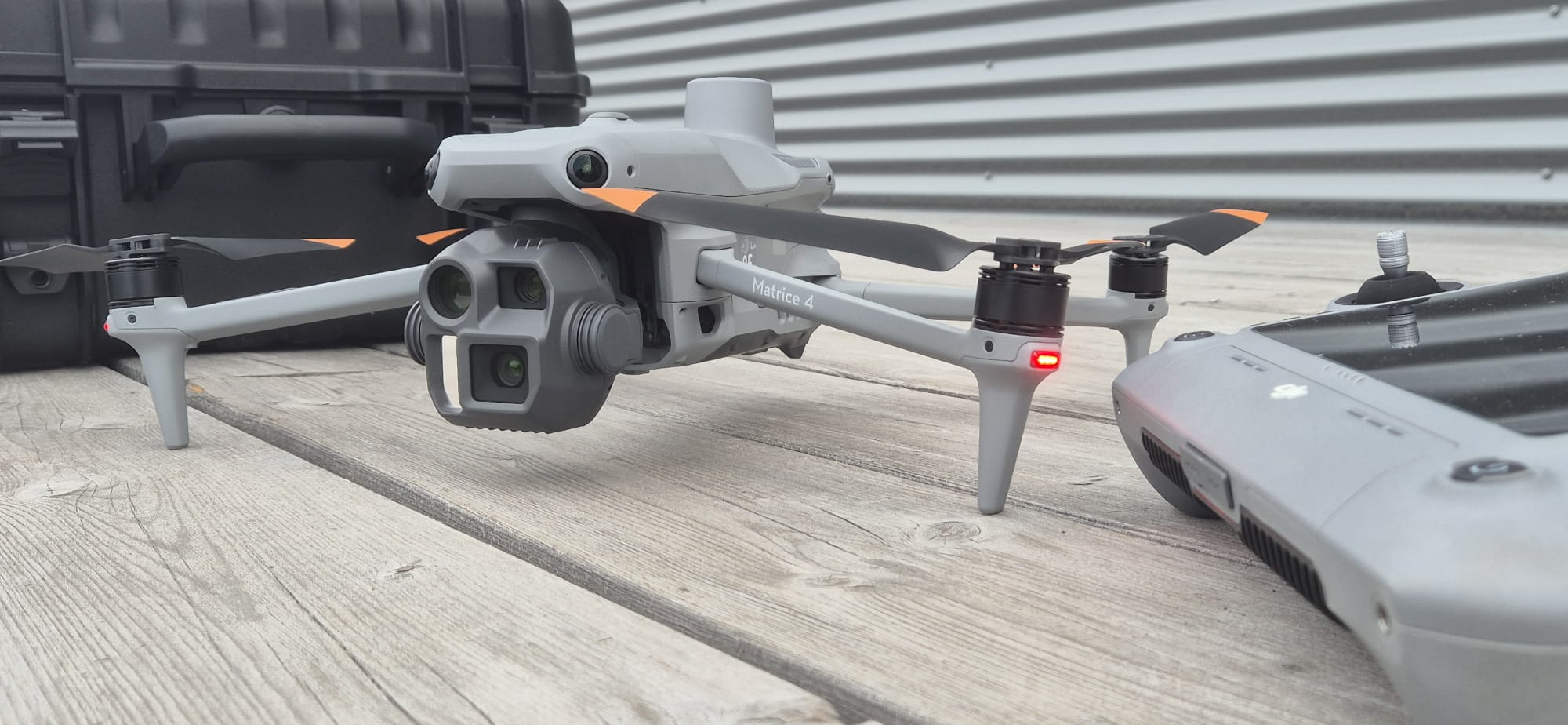 DJI Matrice 4E — 48 MP · RTK GPS
Tell us about your project and we'll get back to you within 24 hours with a tailored solution.